


 and payload. Its called UAS – Unmanned Aircraft System. UAS consist of payload and ground control.What is it for? When we …")
- Digital camera (including Video camera)- Thermographic camera- IR-camera- Radiolocation equipment (Sonar)- Geiger counter")


Emergency controlTasks of agro-industrial complexSnapshots for 3D modelingAgriculture: control of farms & fiel…")

Презентация на тему: Multirotor UAV in project 14.B37.21.1243

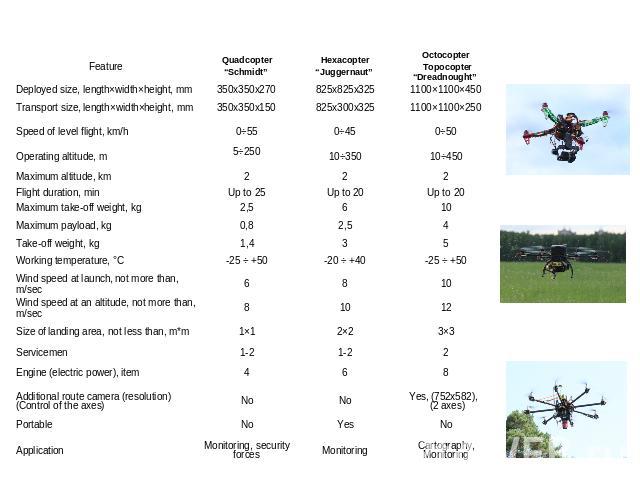
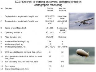
SCB “Impulse”SCB “Impulse”SCB “Krechet”

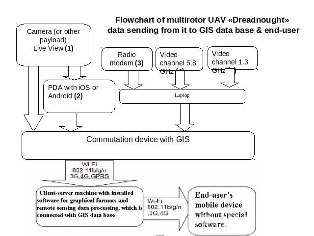
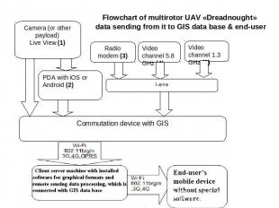
When we use multirotor UAV in cartographic monitoring, it must be considered as a complex with its equipment (instrumentation) and payload. Its called UAS – Unmanned Aircraft System. UAS consist of payload and ground control.What is it for? When we use multirotor UAV in cartographic monitoring, it must be considered as a complex with its equipment (instrumentation) and payload. Its called UAS – Unmanned Aircraft System. UAS consist of payload and ground control.What is it for?- Automatic flight control; - Flight navigation; - Flight task input and processing; - Setting up a wireless link with an operator; Data receiving, processing and storage (Video and Telemetry); - Input of UAV control signals.

- Digital camera (including Video camer")
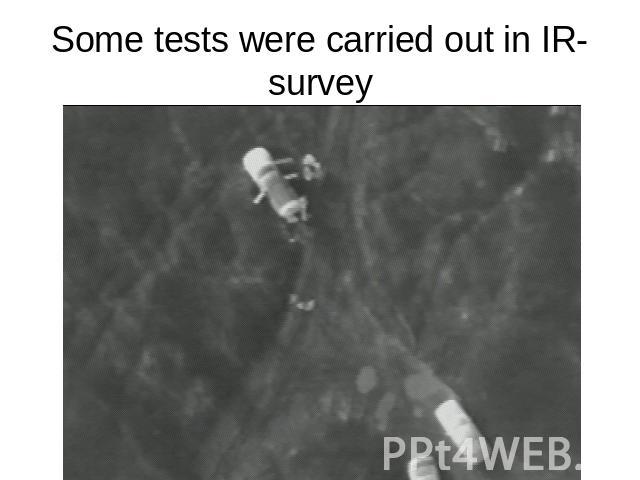
- Digital camera (including Video camera)- Digital camera (including Video camera)- Thermographic camera- IR-camera- Radiolocation equipment (Sonar)- Geiger counter
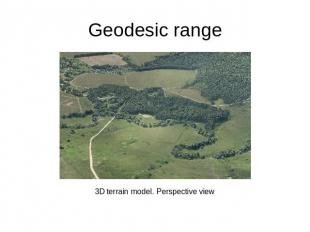
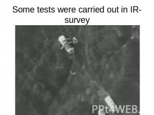


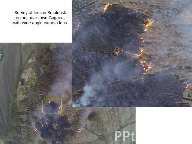
Cartographic monitoringCartographic monitoringTopographic surveyMultispectral surveyThermographic surveyGeology Cadastre (stereo image)Emergency controlTasks of agro-industrial complexSnapshots for 3D modelingAgriculture: control of farms & fields conditionEcological monitoring: - radiation; - chemical pollution; - bacteriological pollution.

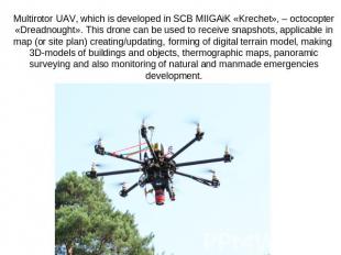
Experience of UAV development, its usage and data processing embeds in educational program of MIIGAiK. Experience of UAV development, its usage and data processing embeds in educational program of MIIGAiK. One of the main tasks of our project (ГИОК ДЗЧС) is a development of special educational courses.


