


 creating/updating, forming of digital terrain model, making 3D-models of buil…")
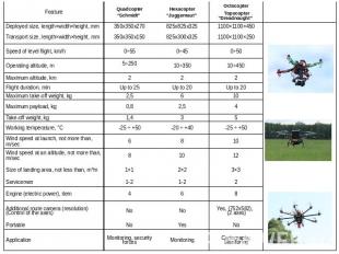
 and payload. Its called UAS – Unmanned Aircraft System. UAS consist of payload …")


- Thermographic camera- IR-camera- Radiolocation equipment (Sonar)- Geiger counter")


Emergency controlTasks of agro-industrial complexSnapshots for 3D modelingAgri…")


Презентация на тему: GIS


Funding: the study was supported by The Ministry of education and science of the Russian Federation. Funding: the study was supported by The Ministry of education and science of the Russian Federation. The project is implemented under the guidance of the invited foreign scientistThe project involves three PhD, 6 PhD students and 6 students from MIIGAiKUsing space and UAVs remote sensing data in emergency situationsUsing open source technologies for making Emergency web-portalCreating multimedia educational online content

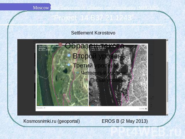
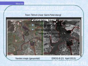
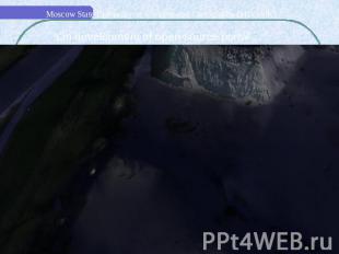
Town Alatyr, Chuvashia regionTown Alatyr, Chuvashia region


UAV developed in MIIGAiK: SCB “Impulse”

UAV developed in MIIGAiK: SCB “Krechet”

Multirotor UAV, which is developed in SCB MIIGAiK «Krechet», – octocopter «Dreadnought». This drone can be used to receive snapshots, applicable in map (or site plan) creating/updating, forming of digital terrain model, making 3D-models of buildings and objects, thermographic maps, panoramic surveying and also monitoring of natural and manmade emergencies development.

Functions & elements of ground control When we use multirotor UAV in cartographic monitoring, it must be considered as a complex with its equipment (instrumentation) and payload. Its called UAS – Unmanned Aircraft System. UAS consist of payload and ground control.What is it for?- Automatic flight control; - Flight navigation; - Flight task input and processing; - Setting up a wireless link with an operator; Data receiving, processing and storage (Video and Telemetry); - Input of UAV control signals.

Data, which is receiving by operators

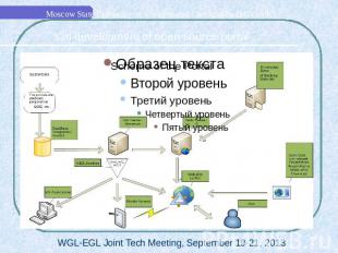
Flowchart of multirotor UAV «Dreadnought» data sending from it to GIS data base & end-user
- Ther")
What can you find in UAV payload?- Digital camera (including Video camera)- Thermographic camera- IR-camera- Radiolocation equipment (Sonar)- Geiger counter

Examples of UAV “Dreadnought” survey:Altitude: 100 metersCamera: Canon 550DCamera lens: 18 mmOverlap: 65%Flight duration: 8 minutesFlight speed on a route: 5 meters/sec

MIIGAiKs geodesic test area

Survey of fires in Smolensk region, near town Gagarin, with wide-angle camera lens

The ways of multirotor UAV usage in environment monitoring:Cartographic monitoringTopographic surveyMultispectral surveyThermographic surveyGeology Cadastre (stereo image)Emergency controlTasks of agro-industrial complexSnapshots for 3D modelingAgriculture: control of farms & fields conditionEcological monitoring: - radiation; - chemical pollution; - bacteriological pollution.

Usage of results in studying & educationExperience of UAV development, its usage and data processing embeds in educational program of MIIGAiK. One of the main tasks of our project is a development of special educational courses.

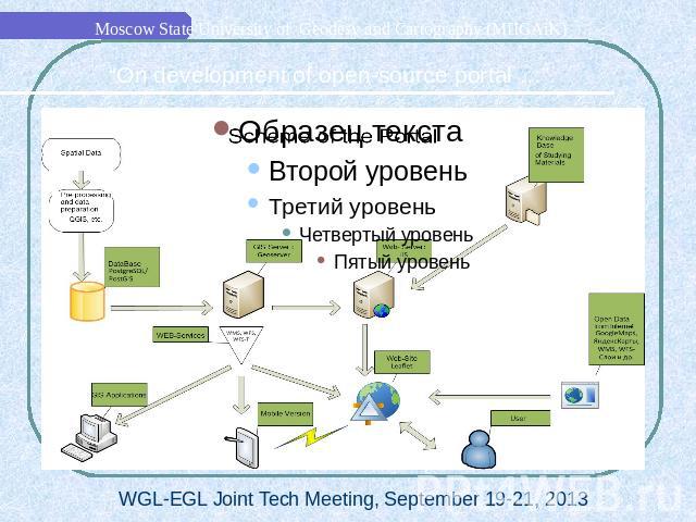
Portal Interface

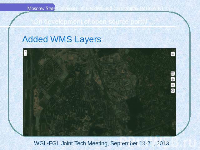
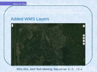
LayersTile LayersWMS LayersWFS Layers

LayersTile LayersWMS LayersWFS Layers

Portal on Mobile DevicesBased on “Phonegap” by CordovaCould save map layers and show it in off-line modeBetter geolocation

3D DataBased on Web-GL technologySpatial Data from UAV3D models from Photoscan

Thank You for Your Attention!


