


 Eastern Europe, Northern Asia Arctic Ocean, Pacific Ocean Barents,…")

 bay (of) currents waterfalls")
 Eastern Europe, Northern Asia Arctic Ocean, Pacific Ocean Barents,…")
 be washed by be separated border on rivers / lakes Arctic Ocean, Pacific Ocean Barents, Laptev, White Seas; Bering Strait; Okhotsk Sea; Black, Asov Seas; BaltiсSea. Volga, Don, Yenisei, Lena, Ob, Baikal, Ladoga, Onega")


 bay(of) currents waterfalls кроме самого маленького")
 bay (of) currents waterfalls")


 surface Eastern Europe, Northern Asia flat: East-European Plain, West Siberian Plain mountains: Caucasus (Elbrus) Urals, Altai")


 continents (6) самого маленького: самого большого: continents")
 island NORTH (Pole) SOUTH WEST EAST (Pole) continents (6) самого маленького: самого большого: самого высокого:")
 Lowland Britain Highland Britain Eastern England Pennines Highlands Mount Snowdon the USA North America north east Pacific coast Eastern area Appalachian Mountains Cordilleras Mount McKinley Ro…")

 USA is one of the English-speaking countries which occupies the middle part of (2) North America and stretches from (3) Pacific to (4) Atlantic Ocean. (5) United States of America borders on (6)Canada in (7) north and on (8) Mexico in (9) South.…")


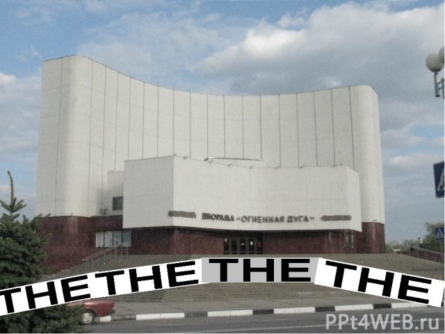
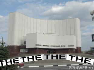
 магазин памятник гостиница ресторан гос учреждение почта телеграф улица площадь the the the the the the the the Артикль the в городе Belgorod *")
Презентация на тему: Артикль the с географическими названиями

ИЗУЧЕНИЕ ГРАММАТИЧЕСКОГО МАТЕРИАЛА «Артикль the с географическими названиями» в 10 классе .

ЦЕЛЬ: ПОКАЗАТЬ СПОСОБЫ ОРГАНИЗАЦИИ УЧЕБНО-ИССЛЕДОВАТЕЛЬСКОЙ ДЕЯТЕЛЬНОСТИ УЧАЩИХСЯ В ХОДЕ ФОРМИРОВАНИЯ ГРАММАТИЧЕСКИХ ЗНАНИЙ, УМЕНИЙ, НАВЫКОВ НА УРОКАХ АНГЛИЙСКОГО ЯЗЫКА И ПРИ ПОДГОТОВКЕ ДОМАШНИХ ЗАДАНИЙ

be situated in/on be located Geographical position of . . . be washed by be separated by border on population capital city climate surface rivers / lakes natural resources

be situated in/on be located Geographical position of . . . be washed by be separated by border on population capital city climate surface rivers / lakes natural resources NORTH+ ern, WEST+ern, in the south, in the north to cover, occupies, island country, on the bank of populous=crowded, densely populated seaboard, coast+al the deepest, longest, purest flows into be rich in cold, temperate, steppe, mild, subtropical, tropical, drought , dryness, driest, changeable flat=plain, flattest, useless desert, heavy forests, mountainous, mostly, mountain ranges, a wilderness

be situated in/on be located geographical position of Russia be washed by be separated border on population capital city climate surface rivers / lakes natural resources (be rich in) Eastern Europe, Northern Asia Arctic Ocean, Pacific Ocean Barents, Laptev, White Seas; Bering Strait; Okhotsk Sea; Black, Asov Seas; BaltiсSea. Belorussia, Ukraine, Georgia, Kasakhstan, China, Mongolia, USA, near abroad about 250 mln, Moscow populous central part cold, temperate and continental, steppe, subtropical flat: East-European Plain, West Siberian Plain mountains: Caucasus (Elbrus) Urals, Altai Volga, Don, Yenisei, Lena, Ob, Baikal, Ladoga, Onega deposits of coal, oil, iron ores, gold, gemstones, gas, forests

THE MAP OF THE WORLD

Артикль the с географическими названиями Find a mistake! oceans seas rivers lakes canals straits gulf (of) bay (of) currents waterfalls

be situated in/on be located geographical position of Russia be washed by be separated border on population capital city climate surface rivers / lakes natural resources (be rich in) Eastern Europe, Northern Asia Arctic Ocean, Pacific Ocean Barents, Laptev, White Seas; Bering Strait; Okhotsk Sea; Black, Asov Seas; BaltiсSea. Belorussia, Ukraine, Georgia, Kasakhstan, China, Mongolia, USA, near abroad about 250 mln, Moscow populous central part cold, temperate and continental, steppe, subtropical flat: East-European Plain, West Siberian Plain mountains: Caucasus (Elbrus) Urals, Altai Volga, Don, Yenisei, Lena, Ob, Baikal, Ladoga, Onega deposits of coal, oil, iron ores, gold, gemstones, gas, forests
 be washed by be separated border on rivers")
geographical position of Russia (RF) be washed by be separated border on rivers / lakes Arctic Ocean, Pacific Ocean Barents, Laptev, White Seas; Bering Strait; Okhotsk Sea; Black, Asov Seas; BaltiсSea. Volga, Don, Yenisei, Lena, Ob, Baikal, Ladoga, Onega

the Arctic Ocean the Pacific Ocean the Barents Sea the Baltic Sea Ladoga the Laptev Sea the White Sea Onega the Bering Strait the Okhotsk Sea the Volga the Don the Black Sea the Asov Sea the Yenisei Baikal the Lena the Ob Russia = the Russian Federation

the Arctic Ocean the Pacific Ocean the Barents Sea the Baltic Sea Ladoga the Laptev Sea the White Sea Onega the Bering Strait the Okhotsk Sea the Volga the Don the Black Sea the Asov Sea the Yenisei Baikal the Lena the Ob Russia – the Russian Federation

Артикль the с географическими названиями the the всё синее oceans seas rivers canals straits gulf (of) bay(of) currents waterfalls кроме самого маленького

Артикль the с географическими названиями Find a mistake! oceans seas rivers lakes canals straits gulf (of) bay (of) currents waterfalls

the USA Pacific Ocean Atlantic Ocean Bering Strait Mississippi Colorado Missouri Gulf of Mexico five Great Lakes Michigan Great Salt lake Niagara Falls the UK North Sea River Thames Thames Severn Irish Sea North Sea Strait of Dover English Channel Gulf Stream Loch Ness Australia Indian Ocean Timor Sea Arafura Sea Torres Strait Tasman Sea Coral Sea Bass Strait Murray Darling Use the where it is necessary:

the USA Pacific Ocean Atlantic Ocean Bering Strait Mississippi Missouri Gulf of Mexico five Great Lakes Michigan Great Salt Lake Niagara Falls the UK North Sea River Thames Thames Severn Irish Sea North Sea Strait of Dover English Channel Gulf Stream Loch Ness Australia Indian Ocean Timor Sea Arafura Sea Torres Strait Tasman Sea Coral Sea Bass Strait Murray Darling How many mistakes have you made? Count, please.

THE MAP OF THE WORLD
 surface Easter")
be situated in/on be located geographical position of Russia (RF) surface Eastern Europe, Northern Asia flat: East-European Plain, West Siberian Plain mountains: Caucasus (Elbrus) Urals, Altai

Russia Europe Eastern Europe Asia Northern Asia the East-European Plain the West Siberian Plain Sakhalin the Caucasus Elbrus the Urals the Altai the Far East the Kamchatka peninsular

Russia Europe Eastern Europe Asia Northern Asia the East-European Plain the West Siberian Plain Sakhalin the Caucasus Elbrus the Urals the Altai the Far East the Kamchatka peninsular
 continents (6) самого маленьког")
the the всё зелено-коричневое кроме capes (мысы) continents (6) самого маленького: самого большого: continents

the the всё зелено-коричневое кроме plains valleys deserts mountains regions peninsular s tops, volcanoes capes (мысы) island NORTH (Pole) SOUTH WEST EAST (Pole) continents (6) самого маленького: самого большого: самого высокого:
 Lowland Britain Highland")
the UK British Isles north-west Europe Britain (island) Lowland Britain Highland Britain Eastern England Pennines Highlands Mount Snowdon the USA North America north east Pacific coast Eastern area Appalachian Mountains Cordilleras Mount McKinley Rocky Mountains Great Plains Mississippi Valley Australia Australia Asia Tasmania Australian continent Great Dividing Range Hamersley Range east coast Great Sandy Desert Great Victoria Desert Simpson Desert Use the where it is necessary

the UK the British Isles the north-west Europe Britain Lowland Britain Highland Britain the Pennines the Highlands Mount Snowdon the USA North America the north the east the Pacific coast the Eastern area the Appalachian Mountains the Cordilleras Mount McKinley the Rocky Mountains the Great Plains the Mississippi Valley Australia Australia Asia Tasmania the Australian continent the Great Dividing Range the Hamersley Range the east coast the Great Sandy Desert the Great Victoria Desert the Simpson Desert How many mistakes have you made? Count, please.
 USA is one of the English-speaking countries which occupies the middle part")
(1) USA is one of the English-speaking countries which occupies the middle part of (2) North America and stretches from (3) Pacific to (4) Atlantic Ocean. (5) United States of America borders on (6)Canada in (7) north and on (8) Mexico in (9) South. It also has a sea border with (10)Russia. The population is over 220 million people. The climate is different in different regions of the country: from mild one along (11) Pacific coast to subtropical in (12) South and cold in (13) North. The continental surface varies greatly because it is the fourth largest country in the world. (14) Cordilleras are located on the coast of (15) Pacific Ocean. Between (16) Rocky Mountains in (17) West and (18) Appalachian Mountains in (19) East are (20) Great Plains and (21) Mississippi Valley. (22) five Great Lakes are joined together by short rivers or canals, and (23) Saint Lawrence River joins them to (24) Atlantic Ocean. The main river of the country is (25) Mississippi, which flows into (26) Gulf of Mexico. The USA is rich in aluminium, coal, natural gas, gold, silver, salt, zinc, oil. It is highly developed industrial country.

the - the the the - the - the - the the the the the the the the the the the the the the the the

I would like to visit …Northern Africa one day. Last year I was in the USA and saw … Niagara Fall. This winter we are going to ski in … Urals. Every immigrant wants to see … America of his dream. They spent summer holidays on the popular resort at … Black Sea. … Lake Baikal is the deepest in the world. I am planning to go through … Sahara on a motorbike. In my childhood I used to spend summer in … Crimea. … Antarctica is the home for penguins, dolphins and whales. She was sent to … Persian Gulf as a war correspondent.

- the the the the the the the - the

There are many beautiful lakes on … Kolsky peninsular. …Kamchatka is famous for its geysers. My boss prefers to spend winter on … Bahamas. … Kilimanjaro is a sacred place for many African tribes. There are many popular skiing resorts in … Alps. … Everest is the highest peak on Earth. Is there life in … Dead sea? … Europe extends from … British Isles in the west towards … Urals in the east. 9. The highest peak in … North America is … Mount McKinley. 10. We had an unforgettable experience in … Austrian Alps. 11. … Taimyr peninsular is a very cold place.

the - the - the - the - , the, the - , the the the

…Russia is situated in two continents: both in …Asia and in …Europe Much of the country covers …Asia, but …European part is more densely populated. …Russia is rich in mineral resources and fertile lands …Eastern part of …Russia is a wilderness where only a small number of people live. 5. …Russia borders on the former republics of …USSR which are called “the near abroad countries” . What is special about the geographical position of Russia? 1. Россия расположена в двух континентах: и в Азии, и в Европе. 2. Большая часть территории находится в Азии, но плотность населения в европейской части выше, чем в Азии. 3. Россия богата минеральными ресурсами и плодородными почвами. 4. Многие территории в восточной части России не освоены, экологически чистые 5. Россия граничит с бывшими республиками СССР – «ближним зарубежьем»

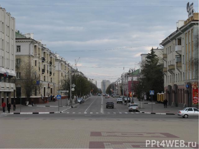
Артикль the в городе
 магазин памятник гостиница ресторан гос учреждение почта теле")
музей театр (кино) магазин памятник гостиница ресторан гос учреждение почта телеграф улица площадь the the the the the the the the Артикль the в городе Belgorod *


")


